Is Wheat Ridge the right place for your everyday routine? If you want suburban ease near Denver with quick access to trails and the foothills, this west-metro pocket deserves a look. You’ll get a feel for parks and outdoor time, daily shopping spots, and how long it really takes to get around. By the end, you’ll know how Wheat Ridge fits your life. Let’s dive in.
Where Wheat Ridge fits
Wheat Ridge sits just west of Denver in Jefferson County, often 6 to 12 miles from downtown depending on your block. That location gives you short drives into the city and a straight shot to mountain recreation. Neighborhoods range from quiet residential streets to busier corridors near Wadsworth Boulevard and 38th Avenue. Housing includes single-family homes, some duplexes, small apartments, and newer infill.
Parks and trails near home
Neighborhood parks you’ll use
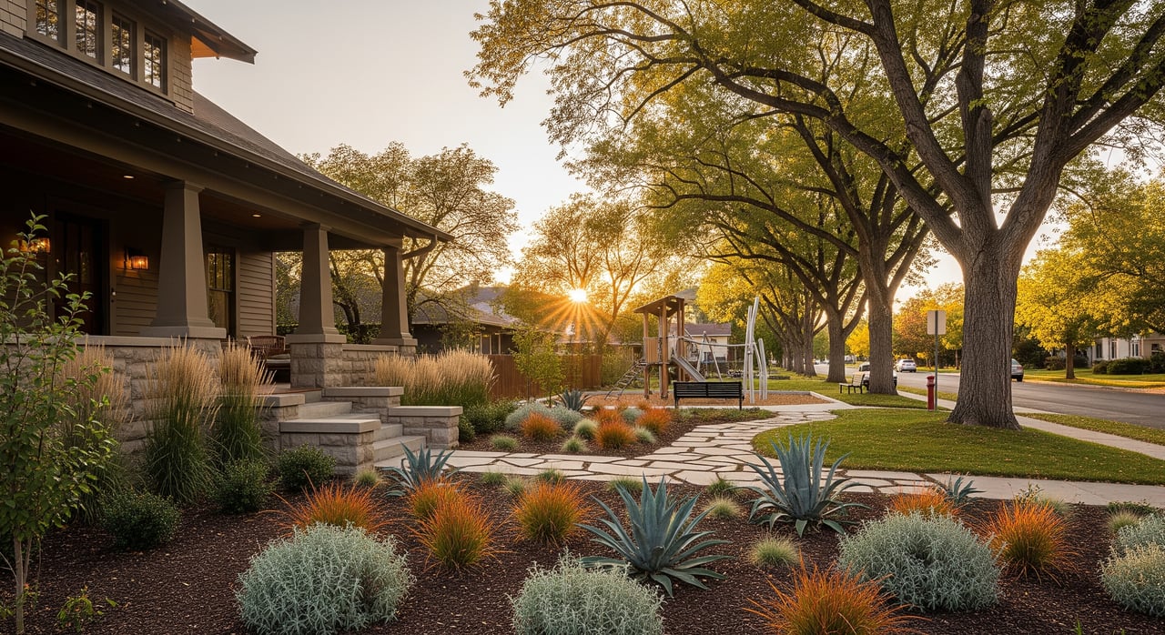
You’ll find a mix of municipal parks, open spaces, and community fields that support daily walks, playground time, and casual sports. One standout is Crown Hill Park, a significant local amenity with open fields, sports facilities, and a golf component. Many parks include picnic shelters and dog-friendly areas. It’s common to build a daily rhythm around a quick loop, a bike spin, or a stop at a playground.
Trail connections for biking and runs
Wheat Ridge connects to the metro-area non-motorized trail network, so you can pedal or jog beyond the neighborhood. Local multiuse paths link to broader routes, including the Clear Creek Trail and connections toward Sloan’s Lake and central Denver. Many residents use these paths for fitness, dog walks, or short bike errands.
Weekend foothills access
Foothills trailheads in the Dakota Ridge, Golden, and Mount Falcon corridors are typically a 20 to 40 minute drive, depending on where you start and traffic. That proximity makes last-minute hikes, mountain bike laps, or sunrise photo runs realistic. In winter, plan extra time for weather and weekend traffic.
Shopping, dining, and services
Wadsworth Boulevard essentials
Wadsworth Boulevard (CO‑121) is your primary north–south corridor for daily needs. You’ll find grocery anchors, pharmacies, fast-casual choices, and big-box retail along the route. Parking is easy and most errands are quick.
38th Avenue and local spots
Closer-in commercial nodes along and near 38th Avenue host independent coffee shops, casual restaurants, salons, and neighborhood services. Expect a mix of local character and familiar chains. It’s convenient for weekend breakfasts, a grab-and-go dinner, or a quick haircut between appointments.
More choices nearby
Because Wheat Ridge borders Lakewood, Arvada, Golden, and Denver neighborhoods, you can expand to nearby districts for specialty groceries, restaurants, entertainment, and larger retail. Many residents hop across city lines for a specific shop or date-night spot, then return to Wheat Ridge for everyday errands.
Commuting and getting around
Drive times and what to expect
Driving is the most common way to commute here. Under light traffic, the drive to downtown Denver is often in the 15 to 25 minute range. During rush hour, plan for 25 to 45 minutes or more depending on your exact start and destination. Foothill trailheads typically fall in the 20 to 40 minute window.
Key routes you’ll use
Wadsworth Boulevard is the north–south spine through Wheat Ridge. Interstate 70 provides major east–west access for both commuting and mountain trips. Traffic varies by time of day and season, so your experience will differ if you leave earlier or later than peak periods.
Public transit options
The Regional Transportation District (RTD) operates bus service in Wheat Ridge. Many commuters also pair a short drive with nearby rail in adjacent cities, using park-and-ride lots for a car-plus-rail trip into Denver. Schedules and stops change, so check current RTD maps and timetables before you plan a daily routine.
Bike, walk, and micromobility
Walkability varies block by block, but many pockets make short trips to coffee, parks, or a corner store easy. Bike commuters use local streets and multiuse trails that feed into longer regional routes. If you prefer a mix of driving and biking, you can park near a trail and ride the rest.
Peak vs off-peak tips
If you can leave 15 to 30 minutes before or after the peak, your drive may be calmer. Winter weather can add time, especially on mountain-bound routes. For weekends, expect heavier traffic on I‑70 during ski season and on sunny summer mornings.
Everyday quality-of-life
Schools and family resources
Wheat Ridge is served by Jefferson County Public Schools (Jeffco), with elementary, middle, and high schools assigned by neighborhood. Families often review current boundary maps and performance data when choosing a home. Childcare, preschools, and after-school programs are common across the area.
Safety and essential services
Local public safety includes the Wheat Ridge Police Department, with some jurisdictional overlap from the Jefferson County Sheriff. Fire and EMS are provided regionally. For an accurate picture of recent trends, review official city or county crime dashboards.
Community rhythm and events
Seasonal activities like farmers markets, holiday parades, and summer concerts in the park bring neighbors together. Recreation leagues, senior centers, and community centers help shape weekly routines. These rhythms are a big part of why many residents choose to stay long term.
Is Wheat Ridge a fit for you?
If you want suburban ease with parks out your door, quick grocery runs, and straightforward access to both downtown and the foothills, Wheat Ridge checks a lot of boxes. You get practical convenience with a mix of local businesses and national retailers. And you keep your weekends flexible for trails, concerts, or a relaxed coffee on 38th.
Ready to explore neighborhoods and find the right fit? Connect with Brian Grace for local insight, clear guidance, and a service-first approach that puts your goals first.
FAQs
How long is the commute from Wheat Ridge to downtown Denver?
- Off-peak drives are commonly 15–25 minutes; rush-hour trips often run 25–45 minutes or more, depending on your starting block and traffic.
Are there parks within walking distance of most Wheat Ridge homes?
- Many neighborhoods are near municipal parks and open spaces; Crown Hill Park is a significant local option with open fields, sports facilities, and a golf component.
Where can I find groceries and daily services in Wheat Ridge?
- Wadsworth Boulevard hosts grocery anchors, pharmacies, fast-casual spots, and big-box retail, while 38th Avenue areas offer independent cafés, eateries, and neighborhood services.
How easy is weekend access to foothills trailheads from Wheat Ridge?
- Foothills destinations in the Dakota Ridge, Golden, and Mount Falcon corridors are typically 20–40 minutes by car, with extra time needed in peak seasons or bad weather.
What public transit options serve Wheat Ridge commuters?
- RTD provides bus service, and many residents use nearby rail in adjacent cities via park-and-ride lots; check current RTD maps and schedules for routes and frequency.
Which parts of Wheat Ridge are most walkable for errands?
- Walkability varies block by block, with pockets near commercial corridors offering easier access; use mapping tools to gauge distances to parks, shops, and transit.
How does Wheat Ridge compare to Lakewood, Arvada, and Golden for amenities?
- You’ll find a similar balance of local businesses and national chains; Wheat Ridge offers quick-access retail plus nearby options across city lines, with commute times varying by exact location.
