If your perfect morning starts with a mesa-top hike and ends with sunset views from your deck, Golden’s foothills might be your spot. You get trailheads minutes away, big skies, and neighborhoods that feel close to nature. You also take on practical tradeoffs like sloped lots, mixed utility setups, and evolving wildfire rules. In this guide, you’ll learn how trails shape daily life, what home styles and lot types you’ll see, and the key questions to ask before you buy. Let’s dive in.
Trails and open space at your door
North Table Mountain
North Table Mountain is a basalt mesa with panoramic overlooks, popular for hiking, mountain biking, and climbing. The park offers 15-plus miles of trails, climbing at the Golden Cliffs, and seasonal wildlife closures, and rattlesnakes are noted on mesa terrain. Get an overview of the trail network on the Visit Golden page for North Table Mountain, and check the county park page for current closures and guidance. Main access points sit off Highway 93, so weekend parking can spill onto nearby streets.
South Table and the Lubahn Trail
South Table Mountain delivers a rugged, close-in hike with a fast reward. The City of Golden controls a modest area on the western slope, but it connects to much larger Jefferson County open space. The steep Lubahn Trail is a favorite local route up the mesa, described by the Stewards of Golden.
Lookout Mountain and Windy Saddle
High above town, Lookout Mountain and Windy Saddle bring big views, strong winds, and an iconic road climb for cyclists. The park draws sightseers and day hikers, and the saddle’s wind exposure even supports paragliding and hang gliding. Get trail and park details from Jefferson County’s Windy Saddle Park page.
Mount Galbraith
Mount Galbraith is a hiker-only loop with rocky switchbacks and sunrise-to-sunset vistas over Golden and the Front Range. Parking lots are small and often fill on weekends, so timing matters for a quiet trail experience. For trail info and tips, visit Mount Galbraith on Visit Golden.
Clear Creek and connectivity
Trail life in Golden keeps getting better. The Clear Creek corridor ties neighborhoods to regional paths, and Jefferson County continues to protect key links and viewsheds. A recent county move to buy land between Apex and Windy Saddle would strengthen connections along the ridge and preserve habitat, as reported by Colorado Community Media. You can also track long-range planning and visitor-management efforts in the county’s region management updates.
Views and what stays open
Golden’s foothills neighborhoods feel open because so much land is preserved by Jefferson County and the City of Golden. Those protected parcels help maintain sightlines and the natural backdrop many buyers value. That said, views are not guaranteed from every property. Some are secured by conservation or public ownership, while others can change as vegetation grows or private parcels evolve. When a view matters to you, look at nearby open-space maps and ask about recent acquisitions and long-term plans.
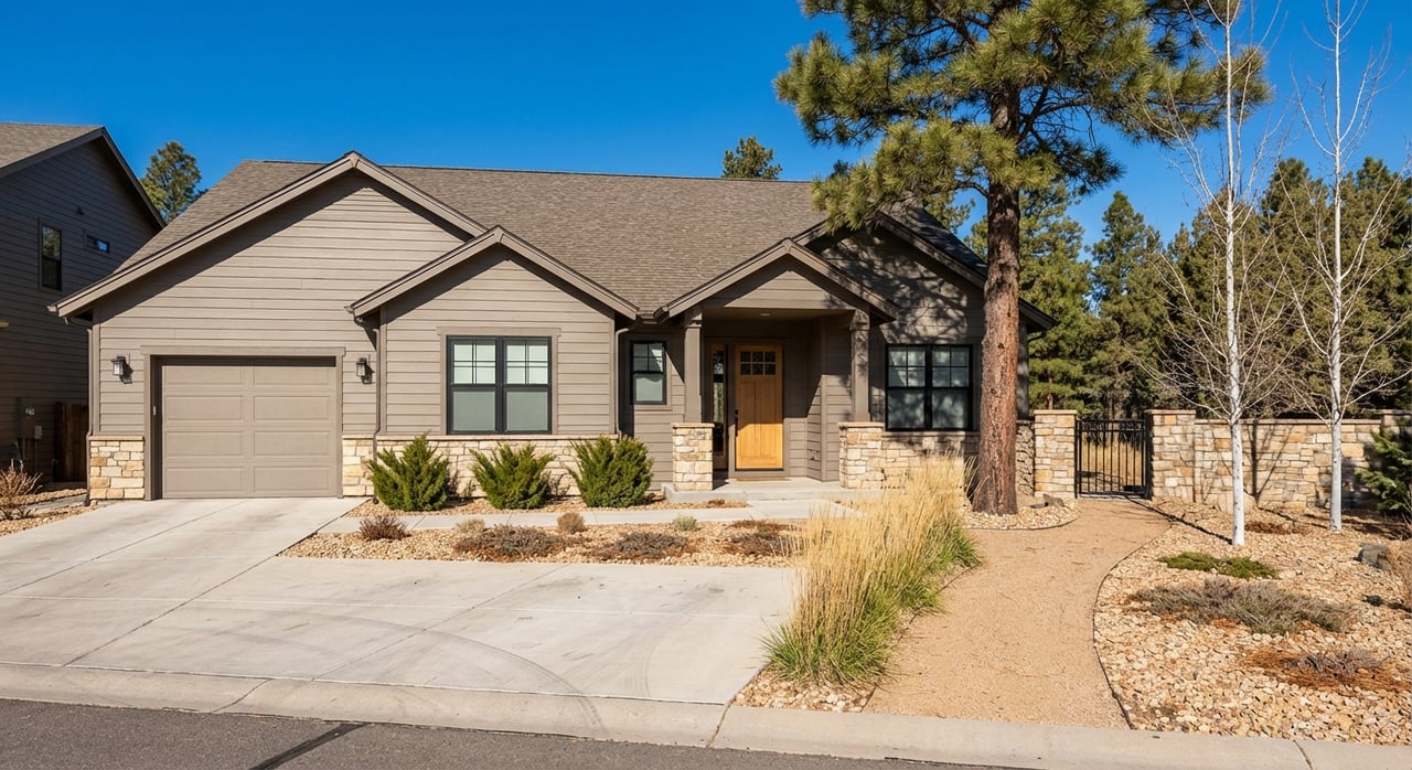
Home styles you will see
Historic to mid-century near town
Close to downtown and on the lower slopes, you’ll find smaller historic cottages and early homes mixed with mid-century ranches and bungalows. Many have been updated to frame mountain views with bigger windows, patios, and open-plan living. These lots are typically smaller and more walkable to town amenities.
Mountain-contemporary and custom up high
Higher on Lookout Mountain, toward Golden Gate or Genesee, parcels tend to be larger, steeper, and more wooded. Homes here often lean mountain contemporary with timber, stone, and large-format glass to capture ridge and valley views. Privacy and acreage can push prices above the Golden median.
Lot shapes and slopes
Foothill lots are rarely cookie-cutter. Expect sloped or irregular parcels, rock outcrops, and micro-drainage channels that call for good grading and erosion control. Retaining walls, careful driveway planning, and site-specific engineering are common. If you plan additions or outbuildings, review setbacks, coverage limits, and any steep-slope or drainage requirements early with county or city resources.
Utilities and access reality
Lower-elevation, in-city parcels are commonly on municipal water and sewer. Higher, more rural-feeling properties are often served by private wells and septic systems. Always verify utilities and service providers on a per-parcel basis during escrow with county resources such as the Jefferson County FAQ and links. For commuting, Golden sits roughly 12 to 15 miles from central Denver, and typical drive times range from 20 to 30 minutes depending on route, time of day, and weather, as reflected in drive distance estimates. RTD’s W Line and bus links offer regional connections, though many foothills residents still rely on cars for daily trips.
Wildfire, weather, and trailhead life
Wildfire rules and mitigation
Colorado’s SB23-166 created a statewide Wildfire Resiliency Code Board that is setting baseline codes for areas near the wildland-urban interface. Local governments must adopt or exceed those standards, and projects like additions or major remodels can trigger review. Learn about the law and implementation timeline on the Colorado General Assembly bill page. In practice, you should plan for defensible-space upkeep, ember-resistant roof and vent details, and insurance conversations during due diligence.
Weekend crowds and parking etiquette
Golden’s most popular trailheads have small parking areas that fill quickly on weekends and holidays. Overflow can reach adjacent streets and bring more foot traffic near access points. Jefferson County and partners continue to study and pilot tools like shuttles and rideshare coordination to reduce pressure in high-use parks, which you can track in the county’s region management updates. If you love instant access, consider how close is too close for your weekend routine.
Wildlife, wind, and microclimates
Foothills living means regular wildlife sightings and a few seasonal hazards. Deer, coyotes, and raptors are common, and rattlesnakes are noted in mesa environments, especially on North Table. Higher elevations see more snow and stronger winds, particularly around Lookout and Windy Saddle. Simple habits help: wear proper trail shoes, watch for closure notices, learn snake awareness, and plan landscaping that respects local conditions and codes.
Buyer checklist for foothills homes
- Confirm water, sewer, or well and septic for the exact parcel. Ask for records, permits, and service provider details.
- Inspect slope stability, drainage patterns, and retaining walls. Look for signs of erosion and water flow during storms.
- Review wildfire requirements for the address and planned projects. Discuss roof, vents, and defensible space with your inspector and insurer.
- Map the nearest trailheads and observe weekend parking patterns. Ask sellers about historic traffic, noise, and event days.
- Verify access and road maintenance. Steeper drives can require more winter attention.
- Check zoning, setbacks, and lot coverage. Confirm any steep-slope or gulch-related limits with county or city staff.
- Evaluate view permanence. Note public open space, private parcels, and vegetation that could change sightlines.
- Assess sun and wind exposure. Orientation affects winter melting, summer shade, and outdoor comfort.
- Ask about utility costs and capacity. Septic age, well output, and municipal tap size all matter over the long term.
- For renovations, confirm permit history and what would trigger modern code compliance.
Neighborhood snapshots
- Beverly Heights, Heritage Dells, and Eagle Ridge: Established lower-slope areas with many mid-century and traditional homes. Elevated settings deliver neighborhood and foothill views.
- North Table, Canyon View, and Wild Plum area: A mix of older foothill homes and newer infill near trail networks, with quick access to mesa trails.
- Lookout Mountain: Higher-elevation parcels with custom and mountain-contemporary homes, often on larger or steeper lots.
- Applewood, Mesa View Estates, and Golden Gate/Genesee: Larger lots with ranch and estate homes, more separation between properties, and a more wooded feel in some sections.
What homes cost, in broad strokes
Golden’s median home values sit above national averages, and foothills parcels with views, privacy, or acreage often trade at a premium. Prices vary widely by neighborhood, elevation, and lot characteristics. The most reliable way to set expectations is to review up-to-date MLS data for your target streets and home types. A focused search with on-the-ground comps will tell you more than a citywide median.
Ready to explore?
Foothills living in Golden gives you instant outdoor access, long views, and a neighborhood feel shaped by open space. The right home balances those perks with the realities of slope, utilities, and wildfire resilience. If you want a steady, local guide who will help you weigh tradeoffs and negotiate with confidence, connect with Brian Grace. Call Brian — Start with a conversation about your home.
FAQs
Will living near a Golden trailhead mean crowds and noise?
- Weekend and holiday peaks can bring overflow parking and more foot traffic near the most popular trailheads, while many hours outside of those peaks remain quiet.
Do Golden foothills properties usually need well and septic?
- Lower-elevation, in-city homes often use municipal water and sewer, while higher or more rural-feeling parcels commonly rely on private wells and septic. Always verify per parcel during escrow.
Are mountain views in Golden protected from future development?
- Not by default. Public open space and conservation can secure some view corridors, but private parcels and vegetation can change over time. Review nearby ownership and plans when views matter.
Should I worry about wildfire rules when buying in the foothills?
- Yes. Statewide baseline codes are being implemented, and local adoption timelines vary. Expect defensible-space standards and potential code triggers for major projects.
How long is the commute from Golden’s foothills to Denver?
- Plan for roughly 12 to 15 miles and a typical 20 to 30 minutes by car depending on route, time of day, and weather. Transit options exist, though many residents drive for daily trips.
